Welcome to a Source on the 1781 Roads in the Orangeburgh District of South Carolina
Or, An Effort to Restore the Past with help from GIS

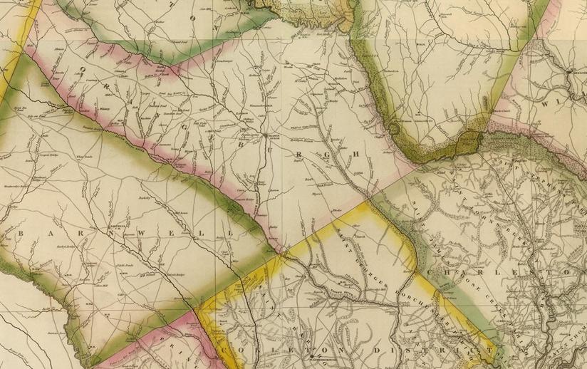
Tanner-Wilson 1822 Map
This map was created from surveys authorized by the General Assembly and represents a basis for geo-referencing of images created from modern map coordinates and images. There are still problems with using this map, nevertheless it includes many roads and features related to the Revolutionary War period that support overlays of modern roads, towns, water features, etc. with period maps.